The History of Tharston
by Paul Cattermole

The History of Tharston
by Paul Cattermole
Chapter 7: Place Names in Tharston
The names of most of the Tharston roads and lanes have undergone so many changes that it is now difficult to recognise some of those which appear in the 18th-century Court Books. Where, for example are Hampher Lane, Hern's End and the Ash Meadow? Stubbings Lane is easier to identify with the present Station Road, in which area much of the woodland had been grubbed up and converted to arable by the beginning of the 17th century. The area was known as "Stubbings Bushes" (a name which refers to the removal of stumps from cleared woodland) ; and the road was called Stubbings Lane until the 19th century. Chequers Lane, was formed when the southern neck of the High Common was inclosed, and the name recalls the old Chequers Inn; where much parish business was transacted, and accounts were doubtless settled on the traditional chequered table. The southern continuation of Chequers Lane was called Stratton Lane in the 18th-century Highway Surveyors' accounts. At the north end of the High Common another new road, laid out in 1805, was called Picton Road as a compliment to the Peninsular War General under whom Sir Robert John Harvey, 19th-century lord of the Tharston manors, served.
Long Lane has had a variety of names, the oldest being Ulsonnes Street, mentioned in a 13th-century charter. The name survives in the Court Books as Wilson Street, although an alternative name, Haycroft Lane is sometimes found. Wood Lane is a name which explains itself, but the older name "Nelland Lane" is no longer used.
Highfields is usually referred to as "Plump", a name which is as interesting as it is uncommon. The Norfolk Militia was organised by recruiting soldiers from the villages in the various Hundreds, and local churchwardens' accounts refer to the provision of guns, swords, bandoliers and corselets, and to the sending of men from the villages to train with the Militia in the "town armour". Tharston and Tasburgh are geographically in the centre of the Depwade Hundred, and it is known from the Tasburgh parish records that the churchwardens there were in charge of a "great gun" in the 18th century. The Fritton churchwardens' accounts, however, refer to sending the town soldiers to muster at Tharston, and an obvious training ground would be on the very extensive Tharston High Common, whose highest point was at Highfields. An old meaning of the word "Plump" referred to a company or troop of soldiers (especially spearmen or pikemen), and it is very likely that the place-name survives from the days when the Depwade Militia met on the High Common. Musket balls have also been found in the area by modern metal detectors.
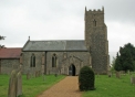
Few of the historic names for roads and houses are now used, but all have an importance in the way they reveal village history. "Upgate", the early name for part of the parish between Picton and Plump, is a relatively common Scandinavian name for a place where a road crosses high ground (as the Forncett Road does here). "Westgate" has now become The Street, and "Churchway" is now partly Hall Lane and partly Hall Road. "Millgate" was the name for the part of Low Tharston nearest Hapton, while the Tasburgh end was known as "Welham Street". The end of Tharston Street was clearly defined in mediaeval times by the "Towns End Meere", at the junction of Wood Lane and Greenway Lane. Older residents of the village describe "Dark Lane", a heavily overgrown track between high banks, running due north from the west end of The Street, which is shown on Faden's map of 1797. This lane, which appears in early documents as both "Towns End Meere" and "Millstyegate", originated as the boundary (=meere) between the inhabited village street and 'Westgate Field", a very large open field which lay immediately beyond. The name shows that it was also used as the pack-horse route (=stye) to the mill; but only the long hedgerow, with fine poplars, hornbeam, crab apple and wild plum survives to remind us of this ancient boundary.
There are a few survivors: such as Horsenford, which is still spelt that way as a reminder that the old plural of the word "horse" ended in "en", like children. Another early name survives for the track which ran diagonally across Westgate Field, clearly a useful short cut from the village to Horsenford. This appears as the "Common Green Way" or "Littlemore Way" in early documents; and survives as Greenway Lane, whose hedges contain a very rich flora, including spindle and dogwood, which confirm an early date.
Some of the lesser place-names in the village take us back well before the Norman Conquest, the earliest names usually referring to landscape features. Nelland Marsh for example comes directly from the Old English for land lying near a river; and a charter of 1213/14 provides two other early names for pieces of land called Brokeolesbusc and Stereswell, which were given by William, son of Richard de Therston, to the Almoner of Norwich Cathedral Priory. The first is probably "Brock Holt Bushes", a piece of shrubby woodland frequented by badgers; and the second is the "steers stream", presumably a low meadow where cattle were pastured. A little later are the Scandinavian names such as the Clints, which means "hill"; and the former names for parts of the village, such as Westgate, Millgate and Upgate which were left behind by Norse invaders and settlers who probably came up the river. Other old names for fields and tenements, found in The Court Books and on the Tithe Map, provide flashbacks to the distant past. Wildcats are known to have lived in mediaeval East Anglia, so "Kate's Hole" may have originated as "Cats' Holt", a piece of woodland where they were to be found. It is sad that the otters have gone from "Ottershill", together with the badgers already recalled; but there are probably still cattle grazing on "Murrays Pasture", "Summerstalls" and "Calves Pightle", and sheep folded on the "Great Sheep Close" from time to time. The name "Burnt Close" perhaps tells us how the ground was cleared for cultivation, while "Stony Lands" and "Clubfoot Close" suggest difficult pieces of ground. "Pattens Pightle" recalls the footwear that would be recommended for a particularly sticky expanse of the Tharston clay; and there was probably an irony in the naming of "Duford's Folly" and "Gordon's Inch" which is no longer obvious. Basketmakers would have used the young growth from the willows in the "Ozier Can", while "Flaxlands" shows where this important crop was grown in the 18th century.
A few modern names on the Tharston Industrial Estate recall General Harvey's victories in the Peninsular War, although modern businessmen seem less keen to struggle with the intricacies of Spanish pronunciation and spelling than did their Georgian farming predecessors.
Notes:
Page last updated: 4 Jan 2024
© Barbara Cattermole and Family & Nigel Peacock 2024