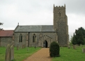
The History of Tharston
by Paul Cattermole

The History of Tharston
by Paul Cattermole
Chapter 4: Woodlands
Woodland was of great importance as a source of both fuel and building material; and as a place where pigs could feed (a herd of 40 swine is mentioned in Domesday). A large wooded area was situated to the west of the village and extended into Fomcett; where the parish boundary runs in a reasonably straight line with little evidence that pieces of woodland were cleared for cultivation and claimed by one parish or the other in Anglo-Saxon times. The earliest section cleared was probably that which formed Westgate Field in Tharston; and the hedgerows on either side of Greenway Lane, which crossed it, are heavily colonised by Dogs Mercury (well-known as a woodland plant), as are many others west of it. Deeds relating to a small grove called "Goldreneshegs", just across the boundary in Forncett, survive from 1394; and by the middle of the 15th century this appears to have been isolated by arable inclosures on either side.
A deed of 1491 describes a piece of arable land as lying in "Okardyngfeld" - literally the field in the oak redding (= clearing), confirming that the oakwood had been cleared and broken up by ploughing. Another clearing, or "Readinge" is mentioned in a deed of 1594, showing further depletion of the woodland; and the Court Roll name, "Inhams" for the Hill Farm (Tharston) land is one commonly attached to land reclaimed from the manorial waste, including woodland. Field names such as "Stubbings" and 'Newbrokeup Piece', shown in the Inclosure map of 1804 are further evidence of ground which was probably reclaimed in the 15th century. In 1706 the Tharston Bread Field was still described as being bounded on two sides by "the Wood called Thardeston Wood", and lying beside "Nelland Lane" (Wood Lane); but the final depletion was soon to take place. The Court Book for 1720 records a licence granted to The Revd. Dr. Edward Tennison (Archbishop of Canterbury) to fell and eradicate trees on his copyhold lands in Tharston over the next seven years; and a map of the estate of Thomas Woods, drawn in 1756, shows that the woodland had by then given way to neat rectangular fields lying beside Wood Lane. Accordingly, a deed of 1781 relating to the Bread Field refers to "the place heretofore called Thardeston Wood".
The gradual retreat of the woodland shows clearly on the 1805 Inclosure map, where old houses on the west side of the present Chequers Lane (from Hill Farm southwards) occupy sites which were formerly on the boundary of the common land and the oak wood. The irregularly shaped paddocks and small closes which surround the houses were originally illegal inclosures (or purprestures) carved out of the common land, perhaps in the 14th century; while the neat rectangular fields behind them were the result of planned clearance of the woodland, which took place rather later. The two lokes (at Spreadingoak and Hill Farm) were intended to provide access through the arable land to the woodland, as its frontier receded from the common.
A small piece of the ancient oak wood survives on private lane to the west of Chequers Lane, containing the remains of the Tharston Oaks, which received mention in Grigor's Eastern Arboretum of 1841. White's Directory (1883) describes: "an extraordinary oak tree, supposed to be at least 500 years old. Though of the pollard kind its boughs cover a space of 90 yards in circumference. At a foot from the ground its trunk is 26 feet, and at five feet high 24 feet in circumference. At six feet from the ground it is divided into two great trunks, which, four feet higher, diverge into five grand divisions, each about the size of an ordinary tree". Although the great oak was burnt out about 40 years ago, the stumps of six large trees remain in an area of rough underwood, now preserved.
A particularly interesting survival of Tharston Great Wood is a length of its ancient boundary bank, which separated the woodland from the grazing marshes bordering the river. A high-species hedge, with several very large oak trees can be traced north from a point in Forncett St Mary near the site of Cancer Barn (a name which recalls the old causeway or "carnsey" crossing the marshland) into the parish of Tharston. The section of bank which lies in Tharston rises gently from a deep ditch, has large coppice stools of alder and hazel, a valuable woodland resource from which poles and laths were harvested; and the records of Fomcett manor show that there was about one acre of grazing to be had along the Tharston woodbank. The land above the woodbank was perhaps cleared for ploughing in early mediaeval times; and this section shows the enormous build-up of soil where the ploughs turned at the end of each furrow.
Notes:
Page last updated: 4 Jan 2024
© Barbara Cattermole and Family & Nigel Peacock 2024